GEO Heritage

Safety
Tips
GEO
Sites

Trails & More

Local
Food

Membership
Tours
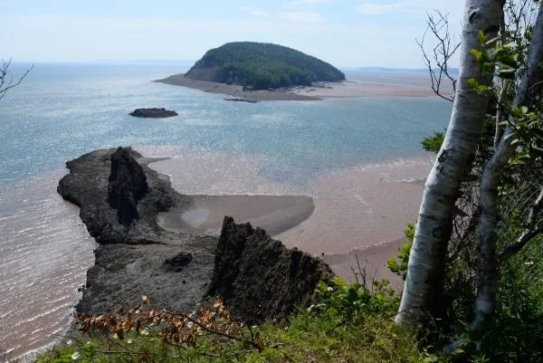
Clarke Head
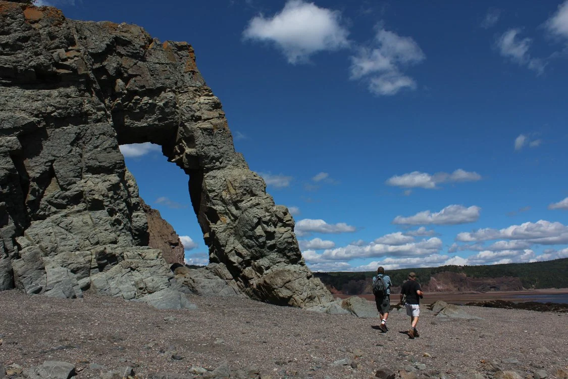
Here, a natural arch sculpted by powerful waves and Fundy tides is a highlight of one of the most intriguing stretches of coastline within the Geopark. Clarke Head is a 1.5 km (1 mi) continuous outcrop where deeply buried rock salt has risen along a fault, bringing up a variety of house-sized blocks with it. Walk among these impressive sea stacks and experience the finest outcropping salt wall in the Western Hemisphere.
To access Clarke Head, check in at the Glooscap Campground office for directions to beach parking and important tide safety information.
Geological Formation: Clarke Head Mélange
Age: Deformation involves rocks of Devonian and Carboniferous age (circa 320 million years)
Directions: Follow Two Islands road east from the Fundy Geological Museum to Glooscap Campground. Check in at the office where you will be provided directions to beach parking. Head left (east), minding the “pinch point” where the rocks change from red to grey at the Clarke Head Fault. Give adequate time for your return before high tide.
GPS Coordinates: 45.380945, -64.241819
Tide Times: http://www.tides.gc.ca/eng/station?sid=255
Clarke Head Arch Ocean Floor Guided Tour - Tide Rollers and Mudlarkers
Take a guided coastal hiking tour at low tide within the Cliffs of Fundy Geopark to the gigantic Clarke Head Arch. Admire the breathtaking Bay of Fundy coastline and explore extraordinary prehistoric rock formations. Visit Tide Rollers and Mudlarkers’ website for more information.

Photo: Tourism Nova Scotia / Photographer: Davey and Sky (@daveyandsky)

Other Popular GeoSites
-
![]()
Ward Falls